GEORGIA — Hurricane Florence is rapidly intensifying and could strike a direct and dangerous blow anywhere from the Carolinas to the Mid-Atlantic region later this week, possibly as a fearsome category 4, forecasters said. The first impacts were already being seen Monday on a barrier island, as seawater flowed over a coastal road.
A hurricane hunter plane found Florence strengthening quickly, reaching top winds of 85 mph (140 kph) Sunday evening after crossing the 74 mph threshold from tropical storm to a hurricane earlier in the day.
Forecasters said Florence could become an extremely dangerous major hurricane sometime Monday and remain that way for days.
As of 5 a.m. EDT, Florence was centred about 1,005 kilometres southeast of Bermuda, moving west at 15 kph. Its maximum sustained winds were at 165 kph. Drawing energy from the warm water, it could have top sustained winds of 209 kph or more by Tuesday, the Miami-based National Hurricane Center said.
Hurricane Isaac, much farther out to sea, has become the 5th named hurricane of the 2018 Atlantic season, the hurricane centre added.
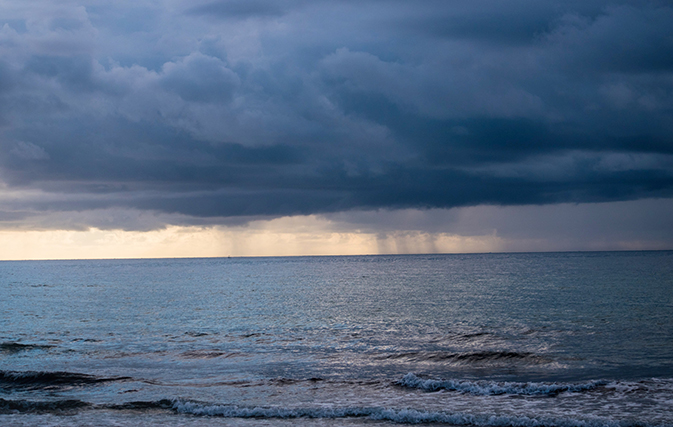
It’s too early to know the exact path of Florence, but forecasters said it could blow ashore by Thursday in the Carolinas and southern Virginia, a stretch of the U.S. East Coast that experts have identified as the most vulnerable to rising sea levels due to climate change.
Up and down the densely populated coast, residents have been told to prepare, and not just for a possible direct blow. Florence could slow or stall on or near shore, scooping up massive amounts of seawater. Some forecasting models show it could unload a foot or two of rain in places, causing devastating inland flooding. Forecasters also warned of a rising threat of life-threatening storm surge, along with the damaging winds.
Since reliable record-keeping began more than 150 years ago, North Carolina has only been hit by one Category 4 hurricane: Hazel, with 130 mph winds in 1954.
The governors of North and South Carolina and Virginia declared states of emergency far ahead of the approaching storm.
Navy ships off Virginia’s coast were preparing to sail out of the path, a North Carolina university has already cancelled classes and people have begun stocking up on plywood, bottled water and other supplies.
Red flags have already been flying on beaches, warning swimmers to stay out of the water as seas began kicking up. People rushed to get emergency kits ready, map out escape routes, fill sandbags and secure their homes.
“Pretend, assume, presume that a major hurricane is going to hit right smack dab in the middle of South Carolina and is going to go way inshore,” South Carolina Gov. Henry McMaster said. The state’s emergency management agency said it is “preparing for the possibility of a large-scale disaster.”
In coastal Charleston, South Carolina, city officials offered sandbags to residents. Myrtle Beach Mayor Brenda Bethune urged people to secure their homes but said it was too early to know if evacuations will be ordered.
Myrtle Beach hardware stores and supermarkets were busy ringing up sales of bottled water, plywood and generators.
“Literally, they are filling buggies full of water, shopping carts full of water,” Ryan Deeck, grocery department manager at a Walmart, told The Sun News. “They’re coming in and buying water and plates, and that’s about all they’re buying.”
North Carolina crews were getting bulldozers and chain saws ready.
In Jacksonville, North Carolina, about 32 kilometres inland, some residents picked up hurricane supplies during their normal weekend shopping, The Daily News reported. Ilija Cesal told the newspaper he wouldn’t worry about buying extra water or other supplies for a few more days.
“I’ll see by Wednesday how that goes – we got over 48 hours before that happens,” Cesal said.
Meanwhile Carnival Cruise Line has re-routed its cruise ships.
Lining up behind Florence, Isaac was about 1,985 kilometres east of the Windward Islands with top winds of 120 kph early Monday, moving west at 20 kph. It should accelerate over the next 36 hours, but poses no threat to land at this time.